


Rebooting the Parkway Limited

In 1981, the Parkway Limited ran from Greensburg to Pittsburgh to relieve congestion due to construction on the Parkway East. Due to low ridership and the end of the construction, the route was canceled after less than a year. It is time for policymakers in Westmoreland and Allegheny Counties to bring back rail options for commuters and reboot the Parkway Limited.
Problem
Below is a map of the Pittsburgh region. Red areas emit more carbon per household in the ZIP code than blue ones.1 Urban areas and rural areas are, by and large, blue while suburban areas are red. This is due to people commuting from the suburbs to urban areas for work via single-occupancy cars. One of the best ways for communities to reduce their carbon emissions is to provide alternatives to driving for people’s commutes. The T provides this for the South Hills, but the light rail system does not touch the rest of the suburbs.

Commuting to Pittsburgh from the eastern suburbs has a problem, to get to the city via the interstates in the most direct way, you need to go through a set of tunnels. The Squirrel Hill Tunnel is infamous for causing traffic jams by just existing; there is almost never a backup on the eastern side of it. As a kid, we avoided driving into Pittsburgh from Latrobe during rush hour due to the way the tunnels tie up traffic. They also are a choke point. Above the tunnel is the affluent neighborhood of Squirrel Hill, so there is no way to go over the mountain or cut through it. The only way to expand commuting capacity from the east would be to bore another tunnel or provide another option for commuters to get to the city.
.jpg")
Solution
Currently, the Pennsylvanian runs once a day to Pittsburgh along tracks east of the city. Those same tracks, with some upgrades, could be used for commuter rail. Frequent service from at least Irwin to Edgewood-Swissvale, and back, would go a long way to reduce traffic. To further reduce traffic, I would extend service to Pittsburgh and Latrobe. This would be one-stop further than the old Parkway Limited.
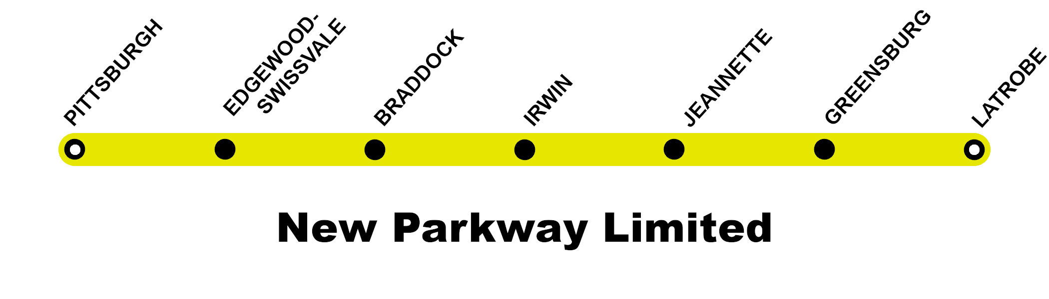
Stations
The first two stops, from the east, intersect the Martin Luther King Jr. East Busway at its first and last stop. Theoretically, the eastern terminus could be moved to Edgewood-Swissvale and riders could then get into central Pittsburgh that way. But I think that riders would prefer to not make the change and would want to ride the whole way into the city. Edgewood-Swissvale is near the Squirrel Hill Tunnel and offers a chance for people taking the Parkway into Pittsburgh to switch to public transportation before the tunnel and an interchange with the Parkway East.
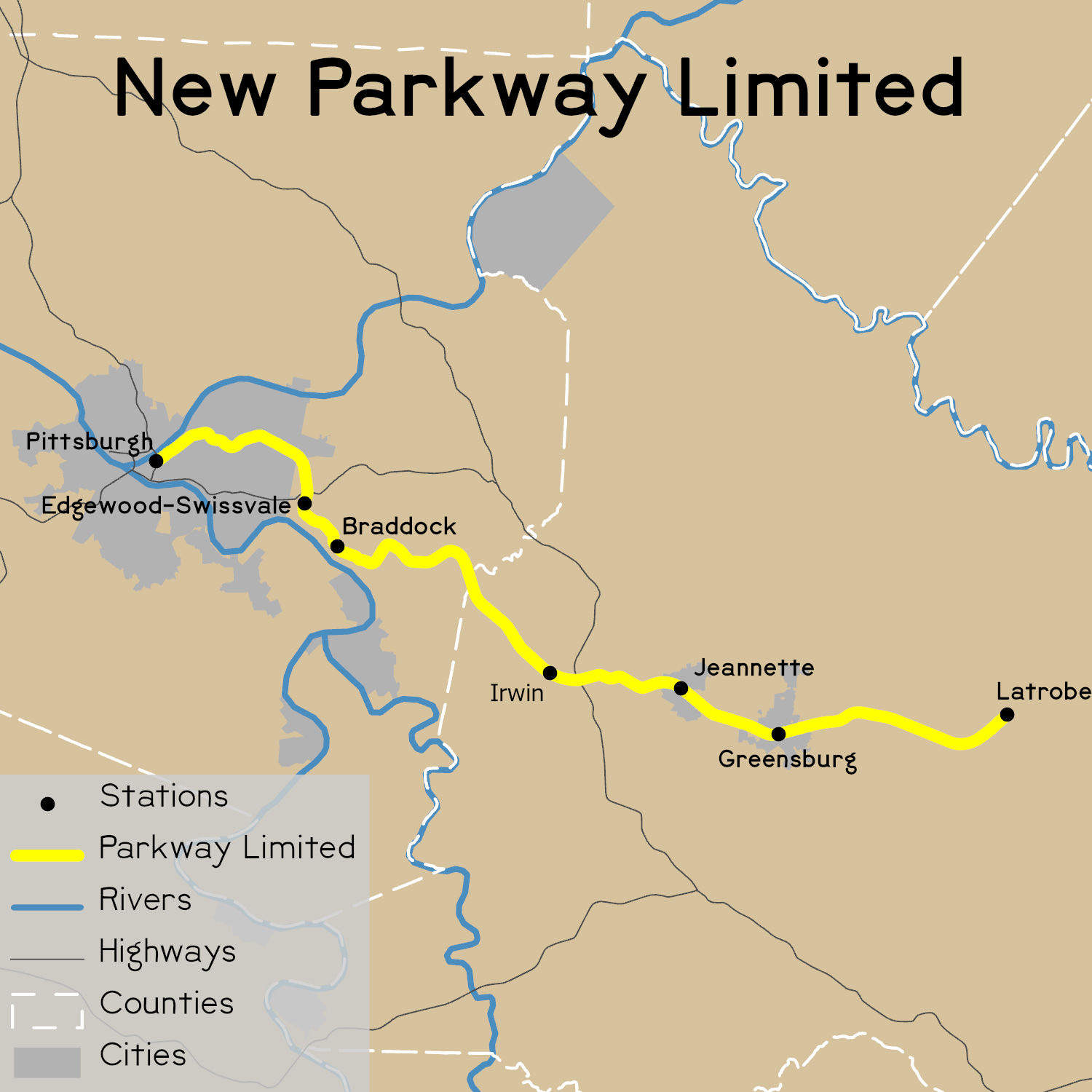
From there, the proposed train goes through a string of towns and cities that are either suffering from post-industrial decline or are expanding bedroom communities. Braddock was a steel town until the 1980s when the mills closed. Since then, the population has plummeted. Over the past few years, it has been trying to attract investment. Having a fast and reliable link to Pittsburgh would help that effort. Irwin gives the route an interchange with the Pennsylvania Turnpike and services the suburbs in the easternmost part of Westmoreland County.
Jeanette, Greensburg, and Latrobe service the outermost eastern suburbs of Pittsburgh. These areas have been reducing in population for my lifetime and need a shot of adrenaline. While they aren’t the traditional areas for long-haul public transportation, there is a cadre of people who drive, up to an hour, into Pittsburgh and out to the outer suburbs each day. They burn more than a gallon of gasoline in each direction; getting these drivers off the road is important for combatting climate change. Plus, there are some big upsides to taking the train in from these places. Imagine if the train had free WiFi and you could bill your morning and evening commute as part of your work day!
Sure, the line could stop at Greensburg and have no downsides, but I am from Latrobe and since this is my proposal, I can insert some patronage as a treat in my own proposal.
CoolClimate Maps, U.C. Berkeley CoolClimate Network, 2013, http://coolclimate.berkeley.edu/maps