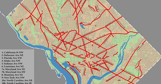
I posted an older version of this map on social media last week, but reviewers on Wikipedia thought that it would have better encyclopedia value if the streets were labeled. After a weekend of hand-placing labels, here is the result. If you click on the image, you will get the full-resolution version.
When you look at this map you will see something that DC natives told me when I moved to the area: state-named streets do not make a lick of sense. Take Maryland Avenue; 7a and 7b on the map. It darts across the city in seven non-contiguous sections. At least all of them are on the same plane and, outside of the capital, only misses a block. Delaware Avenue (2) has three sections that are randomly placed across Washington, DC’s city plan. The smallest section is the nub right off of Washington Avenue SW (16).
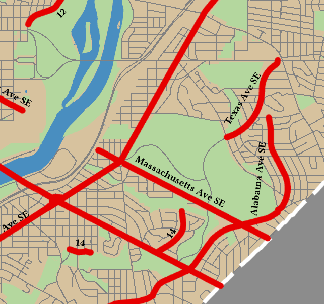
Texas Avenue SE (14) is pure chaos. It exists in three non-contiguous that are not on the same plane as one another. Further, the northern section abruptly turns into Fort Davis Drive when after the intersection with Ridge Road SE. It could extend to Pennsylvania Avenue SE, but in the infinite wisdom of some city planner in the 1900s that was too easy of a thing to do.
In the days before GPS, did the police and fire service just know which parts were which based on the house numbers? This seems like a disaster waiting to happen.


Ah, a question I know the answer to! Before GPS firefighters memorized all the anomalies in a given area so they could respond w/o delay. Sometimes these ‘secrets’ were closely guarded. My husband was gifted a sheaf of index cards which catalogued every odd street in Arlington, several inches thick!