Five Possible High Speed Rail Links to Pittsburgh (Part 2)
New York and Conclusions (also, COVID vaccine)
This is part two of my two part series examining five routes between the North East Corridor and Pittsburgh, PA. Part 1 which looks at the lines that go mostly through Pennsylvania and Maryland can be found here. I also released a map of all of the Class I Railroads in the eastern US.
As a refresher, I decided to sketch out the possible alignments to route HSR between the NEC and Pittsburgh, PA. In that process I found five routes that followed my criteria:
Baltimore & Ohio Main Line
Pennsylvania Railroad Main Line
Buffalo Line
Southern Tier Line
New York Central Water Level Line
Routes
Southern Tier Line
755 miles
3h 26m @ 220 mph
5h 0m @ 150 mph
The southern tier line is a bit of a wildcard. Named after the Norfolk Southern Southern Tier Line that it follows for part of the alignment, the route cuts through parts of New York State that I do not know well.
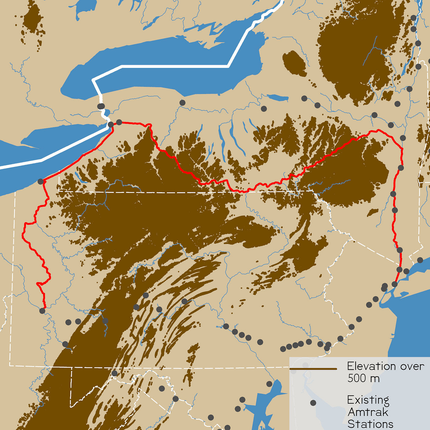
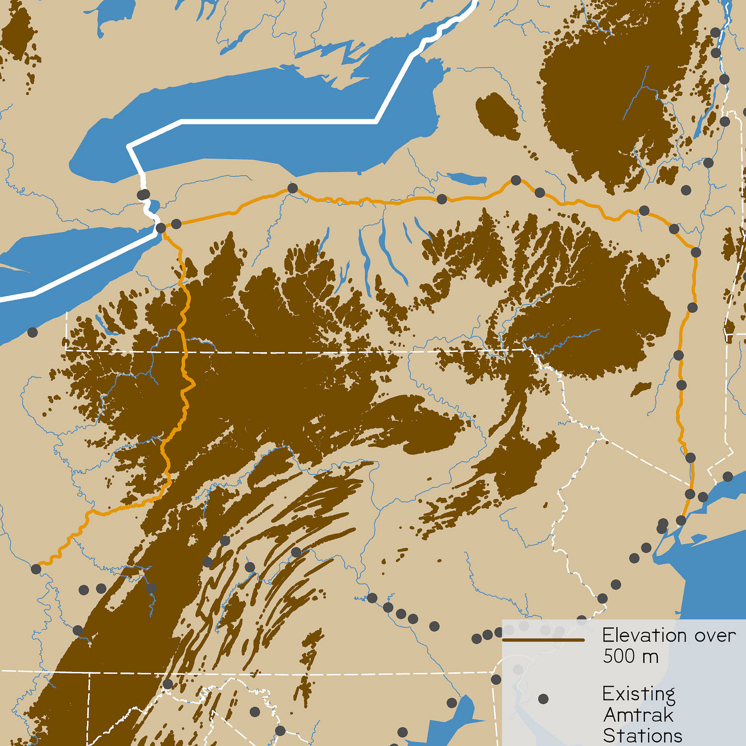
Starting in New York City, the route follow the Hudson river until just south of Albany. At that point, it cuts south east overland, crossing the watershed boundary, until it meets Cobleskill Creek near Schoharie. At that point it follows the upper Susquehanna River (passing through Binghamton) until Waverly, NY near the Pennsylvania boundary. At that point it cuts back north through Elmira and Corning until it reaches another watershed divide and then rolls into Buffalo. At that point it skirts around Lake Erie until it hits Erie, PA. At that point it cuts south to Pittsburgh.
This route is too long, too rural, and goes over too many watershed divides for no good reason when the NYC Water Level Line exists.
New York Central Water Level Line
714 miles
3h 15m @ 220 mph
4h 46m @ 150 mph
In the golden age of rail, the New York Central Railroad (NYC) was the major competitor to the Pennsylvania Railroad; Its crown jewel was the Water Level Route. NYC exploited the fact that there is a break in the worst of the Appalachian Mountains in central New York. This allowed for the Erie Canal and NYC to not have to grapple with the topography as much as the PRR in the south. Today, Empire Service and the Lakeshore Limited run over most of these tracks. This route, from New York City to Buffalo, is in both Twu’s map as well as Levy’s map.
The alignment starts in New York City and follows the Hudson River to Albany. Near Albany, it crosses over to the Mohawk River and roughly follows the path of the Erie Canal through Utica and Rome. Between Rome and Syracuse, like the Erie Canal, the track crosses the watershed divide and follows a series of rivers and creeks until it reaches Buffalo. At Buffalo, the alignment splits from the Lakeshore Limited (which goes on to Chicago) and cuts as directly south as possible through some of the most rural parts of Pennsylvania.1 This involves climbing into the mountains and the descending to DuBois, PA. At DuBois, the route meets a series of rivers and streams that it follows to Pittsburgh.
This route makes sense up until the point where it tries to cut south to Pittsburgh. I think that the most practical route would continue along the Great Lakes, like the Lakeshore Limited. Pittsburgh could be connected to the midwestern route with a short-distance link to Cleveland, OH. This would both tie Pittsburgh to the system and use the geography of the north east and midwest to its full potential.
Just like over 100 years ago, the geography of the Mohawk Valley, Central New York and the Finger Lakes Region makes this route, from east to west, unmatched. The reason that this route was important in 1817 is the same reason that it will be important to any HSR system in the US: a non-mountainous way of getting to the midwest from the eastern seaboard. That should not be ignored when planning any HSR system.
Conclusions
Parts of the Pennsylvania Railroad Main Line should be used for localized high speed rail to bring commuters into Pittsburgh and Philadelphia
If there needed to be a Pittsburgh and Philadelphia connection in the HSR system, there are good reasons to choose the longer and more rural Buffalo Line over the more direct PRR Main Line that connects more mid-sized cities. Still, it is probably not worth it to contend with the Appalachian Mountains.
The New York Central Water Level Line should continue onto Chicago instead of cutting south to Pittsburgh and should probably be the only link between the North East Corridor and the Chicago-based midwestern HSR system in the Middle Atlantic States. Pittsburgh should be connected with HSR through Cleveland, OH.
COVID-19
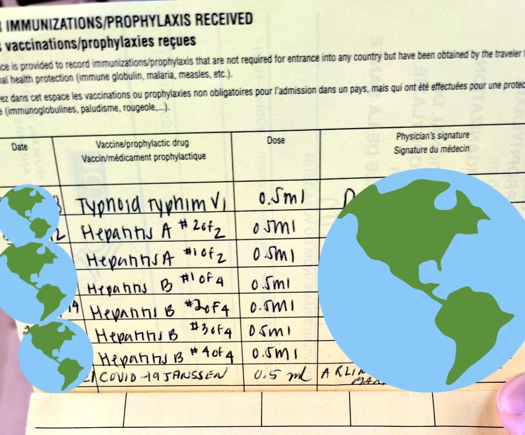
I got my COVID-19 vaccine yesterday. While I have had side effects over the past 24 hours, — pain at the injection site, chills, muscle stiffness, aches, and a singular dizzy spell —nearly all of them went away after taking 500 mg of paracetamol (acetaminophen). I am feeling fine after a rough night’s sleep and taking it easy this morning.
I urge you all to get the vaccine when you get a chance. I am looking forward to getting back to normal after the vaccine reaches full effectiveness in 13 days. I am also looking forward to moving to Europe in the fall and this is going to be required to emigrate.
I am generally showing the two ways I can see cutting from Buffalo to Pittsburgh. The Buffalo to Pittsburgh sections can be swapped between the Southern Tier Line and the New York Central Water Level Line depending on your preferences.


