


Mine Drainage in the Loyalhanna Watershed
Diving into environmental geography

Over the past eleven months, I have made maps of New York City; Washington, DC; Pittsburgh, PA; the Eastern Seaboard; and the United States. However, all of these maps have been large-scale maps with limited detail. I also have been doing quite a bit of political mapping over the past few months and I wanted to get back to making environmental maps. So, I made a detailed map of an area that I know well: the Loyalhanna Watershed. My childhood home is a mile from the watershed boundary and I went to high school inside of it.
If you would like a high-quality copy of the map, it can be found on my server here (24 MB). If you would like it as a poster, it can be found on Redbubble.
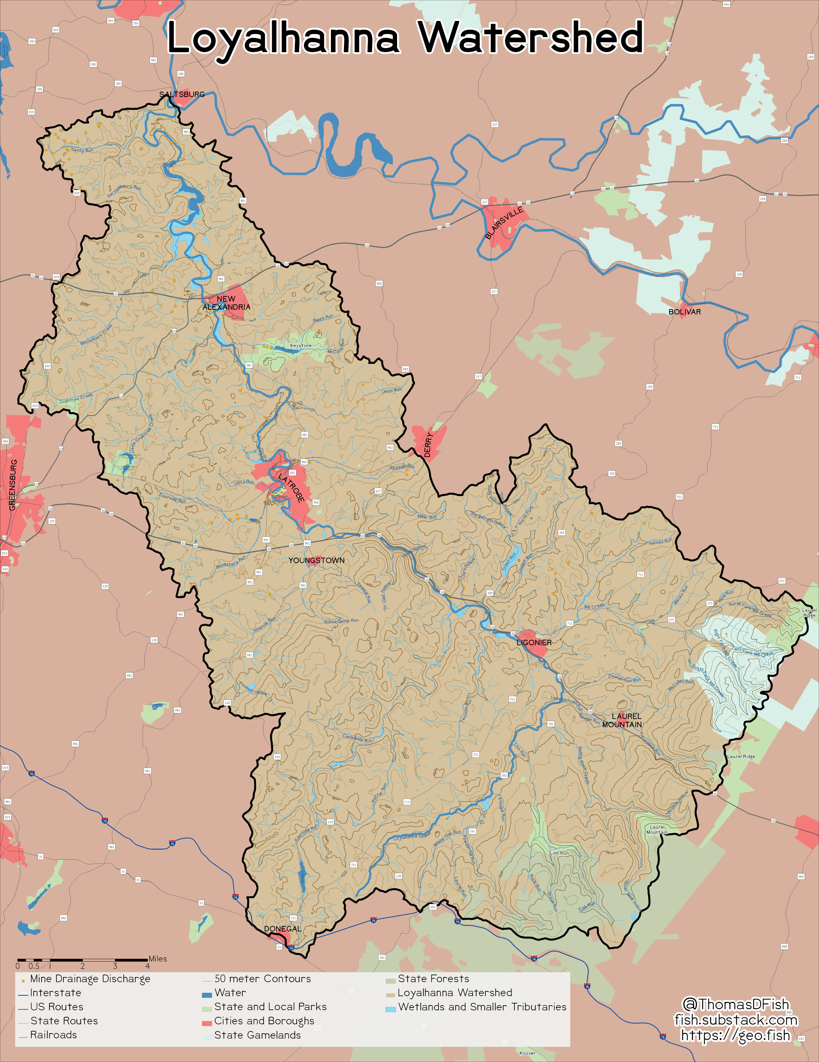
The Loyalhanna Watershed is a 298 square mile (772 square kilometers) area in Southwestern Pennsylvania; about 25 miles (41 kilometers) east of Pittsburgh, PA. The Loyalhanna Creek runs for 50 miles (80 kilometers) from the Laurel Ridge to the Conemaugh River at Saltsburg, PA. On its journey, the creek passes through Ligonier, Latrobe, and New Alexandria.
The area was the site of extensive coal mining between 1800 and 1920. The coal extracted from the ground was shipped to Pittsburgh to power the mills or turned into coke to make steel in ovens cut into the hillsides. The coal was mined in stages, early on, the mines were shallow or drift mines. As the shallow coal ran out, the mines got deeper. These deep mines were below the water table and needed pumps to continuously remove groundwater or they would flood.
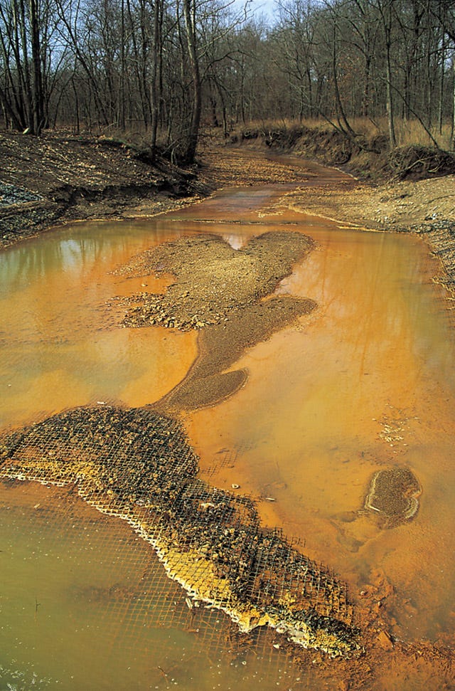
This industrial heritage has scared the watershed. One of the minerals that is sometimes found in coal seams is pyrite. Pyrite looks gold when it comes out of the ground, but it is actually a type of iron ore. When the mines closed the pumps stopped and they filled with water. When pyrite is submerged it breaks down and the iron is put into suspension in the water. When it hits the surface, it turns the water a bright orange color, like in the picture below.
Loyalhanna Creek was orange or orange tinted through Latrobe for the beginning of my childhood due to the various discharges along the creek’s tributaries. For example, there are seven discharges (orange dots) of various sizes along Monastery Run and its main tributary Fourmile Run.1
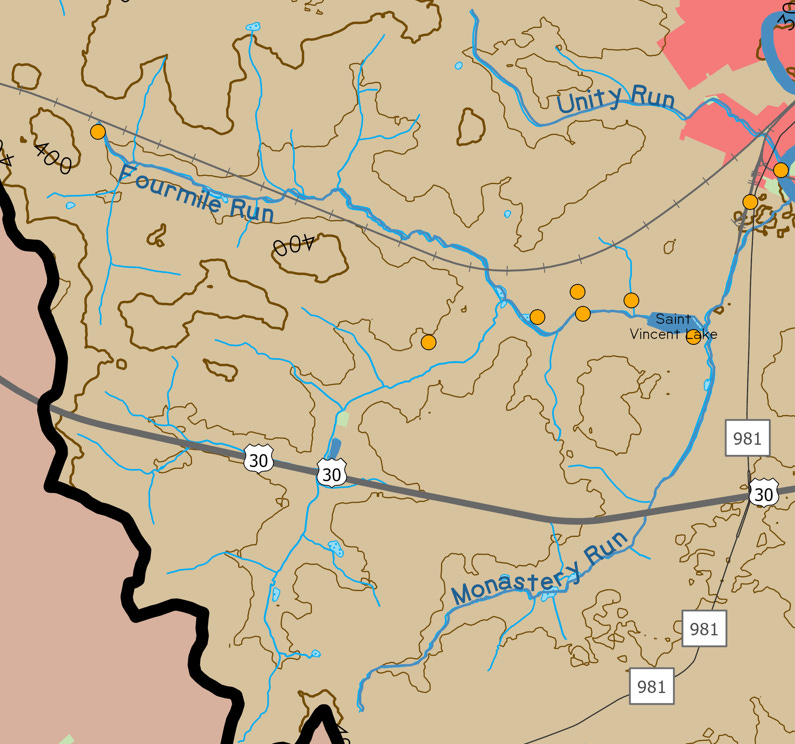
The discharges near Saint Vincent Lake have been partly remediated due to the Monastery Run Improvement Project, but others have proved extremely difficult to capture. The map below shows the discharges in and around Latrobe, PA. The discharge that looks like it is in the middle of the creek on the map below is actually in the middle of the creek.

At some point before the Clean Water Act, they bored a hole from the streambed to the mine to keep basements in the city from flooding. The hole serves its purpose, but it also sends orange water into the stream in the spring. There are discharges that release so much water that there is no practical way to treat them, like the one on Crabtree Creek, and others that have no known source.

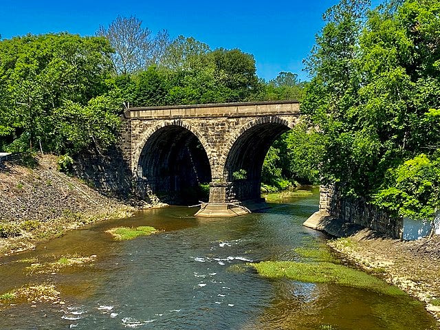
Despite the hard-to-treat discharges, over the last 20 years, there have been massive improvements in water quality. Seeing the Loyalhanna Creek run clear was only a dream in the late-1990s when I first asked my parents why the stream was orange. The picture below from 2020 shows just that.
It was not easy to make the Loyalhanna Creek run clear, but a dedicated coalition of environmentalists, sportsmen, politicians, and academics made it happen. This coalition included people from across the political spectrum that agreed on little other than improving the water quality of the stream; I strongly doubt members of the Rolling Rock Club and the academics agree on tax policy. The Loyalhanna Creek is a good reminder that all environmental problems need broad groups to move the needle. If the chosen “solution” to the creek being orange in 1990 was protesting in Harrisburg, PA and purity testing the sportsmen out because they disagreed about gun control, the creek would still be the same color today.
According to the Pennsylvania abandoned mine land (AML) inventory